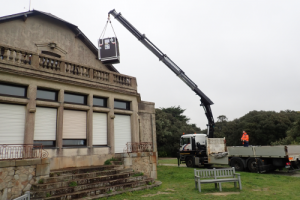

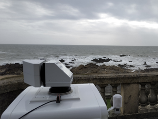
The scanning LiDAR, a wind measurement instrument recently acquired by the LHEEA (summer 2019, funding from the region, ERDF, PIA), was installed on the terrace of the seafront villa in Penn Avel park on the Croisic SEM-REV site on 28 October 2019.
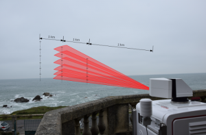
Its deployment meets the needs of two LHEEA research projects on the coastal atmosphere: MATRAC and WAKEFUL, a WEAMEC Project. The location is ideal because of the clear view from south east to south west, the prevailing wind sector in the area.
The LiDAR is configured to measure the wind above the sea at six heights constituting three virtual met masts at 1 km, 2 km and 3 km from the coast. Measurements are taken at 10 min intervals over a 45 ° wind sector. In addition to the specific project needs, this first deployment is the opportunity to acquire experience using this tool and to test new functionalities.
In the framework of the WAKEFUL project, the objectives of the LiDAR campaign at Penn-Avel are measure and develop understanding of the offshore wind resource, engage the first operational deployment of LiDAR in the marine environment, upgrade skills with a view to its deployment at sea.